Finger Lakes National Forest Hikes and Adventures You Should Plan ASAP!

The Finger Lakes National Forest, situated between Seneca and Cayuga Lakes, is somewhat of a hidden gem. It often even gets overshadowed, by the stunning state parks nearby. Certainly don’t sleep on this heavily wooded natural area, though! It is a great place for hiking, camping, and wildlife exploration. This should give you a good sense of which Finger Lakes National Forest hikes are best for you.
There are over 30 miles of trails within the forest for hiking and other recreational activities. This national forest is a place of natural beauty, and visitors are welcome to enjoy the views, walk through the forest, cross over streams on bridges, and view the many birds and other wildlife that can be found in the park. There is something for everyone, from easy nature walks to more strenuous hill climbs. There are also a number of lakes and streams in the forest where you can go fishing.
This national forest is a place full of natural beauty. To experience all of the corners that these acres have to offer, we’ll provide you with a list of the details about each of the established trails.
A quick note: The area management is combined with that of the Green Mountains National Forest. Don’t be confused if you see some information on the web combining the two. The areas aren’t all that close together, separated by a 5+ hour drive.
We’ve arranged them by distance from shortest to longest. Whether you are looking for a quick walk in the woods or an overnight adventure, there are options for each of these Finger Lakes National Forest hikes.
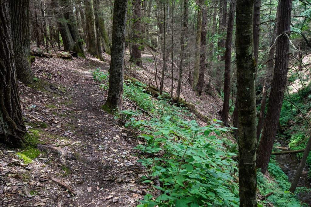
Short Hikes
These trails are all less than 3 miles in length and could be navigated in less than a few hours.
Fossenvue Trail
- 0.5-mile loop
- 30-45 minutes
- Moderate
- Hiking

Find this trail on the newest portion of the national forest land. It is also the only one that leads directly to the shores of one of the Finger Lakes. The trail leads right down to the shores of Seneca Lake and to the historic spots on Caywood Point. (There aren’t any trails that lead up to the shores of Cayuga Lake.)
Caywood Point was the home of Camp Fossenvue, which was known as a meeting place for suffragettes during its time of operation from 1875-1908. Now, only one building is left standing as evidence of the camp, but a small open area provides views across Seneca Lake.
The gravel trail down to the edge of the lake is steep, with inclines nearing 30% and wide switchback turns. While the trail is not long, it could still be considered strenuous due to the steep grades.
There are a few campsites along the water to spend the night if you wish.
Ravine Trail
- 0.75-mile loop
- 45 minutes to 1.5 hours
- Moderate
- Hiking

The Ravine Trail can be found near the Backbone Horse Camp. While it is to only be used for hiking and no horses are permitted on this trail, it does travel through some denser wooded areas.
It also passes across small, seasonal streams. You won’t find panoramic views, but you may find some solace from crowds on the trail here.
This trail does connect to the Interloken Trail, which could be combined for a much longer hike. As in the name, you will cross a ravine, which does provide a few steeper inclines to navigate. With that being said, it isn’t one you should consider skiing in the winter.
Southslope Trail
- 0.75 miles, point to point
- 45 minutes to 1.5 hours
- Easy
- Hiking, Cross-Country Skiing
Find this one on the very southern end of the forest lands.
The Southslope Trail can be considered a short connector between the Finger Lakes Trail and the Interloken Trail. It is very easy to navigate the relatively flat path through the forests.
A section of wooden boardwalk does help you keep your boots dry through the more wet areas. You will pass through several different types of terrain.
If you’re looking for a shorter hike, then this trail is perfect for you.
Gorge Trail
- 1.25 miles, point to point
- 1 to 1.5 hours
- Moderate
- Hiking

Also on the southern side of the forest, you can pick this trail up from a parking area found on the local Mark Smith Road. From there, you can cross over a stream to, yet again, meet up with the Interloken Trail near the Gorge Ponds.
You won’t find vistas but more forested land along this trail, too.
While there isn’t a wide-open vista or a 100-foot waterfall along the trail, it provides great access to more long-distance hiking or a workout of a shorter hike.
Burnt Hill Trail
- 2.25 miles
- Easy
- 2.5 to 3.5 hours
Because this trail passes through open pastures, you will have to go through some fence gates to continue on the trails. Make sure to always close these gates after you pass through. Farmers use these fields for extra space for their cows to graze during the summer, and you don’t want to be responsible for their escape!
The Burnt Hill Trail begins by heading south off of Picnic Area Road. There are a couple of vistas along the trail where you can have wider views, but there is also a great variety of terrain covered on this relatively short trail.
This one is very close to the Blueberry Patch Campground and also connects to the Interloken Trail. It would make a great stroll from the campground if you’re staying there for a couple of days.
Potomac Trail
- 2.25 miles
- Easy
- 2 to 3 hours
- Hiking, Cross-Country Skiing

The Potomac Hiking Trails travel in loops around the Potomac Ponds near the Potomac group campground area. They cover very flat terrain around the ponds, and you can see wildflowers in bloom during certain times of the year.
The area is a popular game bird hunting area, and you can find some dispersed campsites along some of the trails to spend the night, too.
These trails can make great cross-country ski options for more beginner skiers during the winter months.
If you’re looking for a challenge, the Potomac Ponds Trails may not be for you. If you’re just looking to enjoy the nice scenery, keep your eye out for wildlife, and enjoy the area, then this is a great place to go.
Longer Hikes
While this is not the largest in area, there are a few longer-distance hiking options on these lands. Actually, the Finger Lakes National Forest is the second smallest of the national forests, and the only smaller is the Tuskeegee National Forest, which is located in Alabama.
Finger Lakes Trail
- 4.0 miles
- Easy
- 4.5 to 5.5 hours
- Hiking

While only a few of the 599 miles of the main Finger Lakes Trail pass through the forest, you can certainly use this trail for short day hikes or multi-night adventures. There is a variety of terrain, views of Seneca Lake, and a couple of steep grades to navigate, but no part is too difficult.
You’ll also get to pass through some of the vineyards that the area is known for. Be sure to enjoy all of the views!
There is an Adirondack shelter along this portion of the trail and it can be used on a first-come, first-served basis.
While it is always important to always stay on the trail, it is especially important while navigating these sections of the Finger Lakes Trail. Portions do travel on private land, so please be respectful of the land owners who permit trail users to pass through.
No-Tan-Takto Trail
- 4.5 miles
- Easy
- 4.5 to 5.5 hours
- Hiking, Horses, Mountain Biking, Snowmobiling
For hiking in the flat, open cow pastures, this is your trail! There is a mix of private and public land covered on this trail, so be sure to be respectful.
Enjoy the open scenery that this trail has to offer, but you’ll probably want to pack a hat and sunscreen, rain gear, or a windbreaker depending on the forecast during the visit. Make sure you check the weather before heading out, as conditions can change quickly up on the ridge.
Since these pastures are used for grazing cattle during the summer, make sure you close any gates behind you after passing through. They are there and closed for this reason!
This trail is also popular with mountain bikers and snowmobilers. You can actually see both Seneca Lake and Cayuga Lake at points along this trail.
Backbone Trail
- 5.5 miles
- Easy
- 5.5 to 6.5 hours
- Hiking, Horses, Mountain Biking, Snowmobiling
You can probably guess that this trail begins from the Backbone Horse Campground and is popular for horseback riding in the forest.
While mostly flat, it does cross with the Burnt Hill trails and the No-Tan-Takto trail, so you could combine for much longer adventures here. You can also just plan a short hike, but keep in mind that you may cross paths with some horses along the way.
Horseback riding is not permitted in the forest from March 15 – May 1st for preservation as the trails do become especially wet and easily damaged during this time.
Interloken Trail
- 12 miles
- Easy
- 12 to 14 hours
- Hiking, Horses (south end to Burnt Hill, between Seneca and Parmenter Roads), Mountain Biking (north of Burnt Hill), Snowmobiling

The longest trail through the forest lands, it is also one of the hiking trails commonly used for backpacking adventures.
Begin by heading from south to north to get the steeper, hilly sections of trail out of the way first. You can also combine with many of the other trails in the forest to combine shorter day hikes or longer multi-day adventures.
Hiking the entire trail point to point could be done in one day, but you don’t want to rush through the Seneca Lake views and quiet scenery.
Camping somewhere around Teeter Pond or Foster Pond could help you to break up the hike and enjoy a few days.
More About the Finger Lakes National Forest
Including over 16,000 acres spread over Seneca county and Schuyler county, the Finger Lakes National Forest is the only National Forest land in the state of New York. Located just north of both Watkins Glen and Ithaca, it’s home to more of the region’s beautiful, protected scenery.
Before being acquired by the national parks service, the lands were said to be first inhabited by the Iroquois people. The lakes surrounding the forest are said to have the names of two of their nations. They were, however, forced out of the area during the Revolutionary War.
While the forest does not have the same old-growth hardwood forests that it used to showcase, there are plenty of forests, ponds, and open pastures to explore today.
The creation of the Finger Lakes National Forest began in 1938, then called the Hector Land Use Area. Its creation was meant to protect and reestablish abandoned farmlands around the Finger Lakes, caused by the Great Depression. After the continued protection came into question in the early 1980s, it was eventually transitioned and named the Finger Lakes National Forest in 1985.
Frequently Asked Questions
Do you have questions prior to your visit to the Finger Lakes National Forest? These are common questions that we have encountered.
Are Dogs Allowed in the Finger Lakes National Forest?
Pets, including dogs, must be restrained or on a leash while in developed areas, but they are permitted on the trails and other areas of these national forest lands.
Can you camp for free in Finger Lakes National Forest?
Yes! There are a few campgrounds within the lands and stays at these are not free. Dispersed camping, however, is free! There are some rules and restrictions as to where dispersed camping can happen. From May 15 to October 31, no camping is permitted in open pastures along the trails. You should also camp at least 50 feet from trails and water sources. Remember: Practice Leave No Trace!
Can You Bring Your Own Firewood?
Yes, firewood is permitted to be brought with you to the campsites, but it must be obtained from local sources. Be mindful not to bring invasive species of insects to the area from other locations. If you plan to collect firewood during your visit, it should be from only dead and down wood, or a permit should be obtained from the Hector Ranger Station.
Is Hunting Permitted?
Yes, it is! Be sure to know and follow all of the rules and regulations for hunting in the state of New York. Even if you are not a hunter, you should know when the seasons start and end. It is a requirement to wear fluorescent orange while hiking during hunting seasons.
Where does the Finger Lakes Trail Start and Finish?
The Finger Lakes Trail is part of the longer North Country National Scenic Trail, which travels from North Dakota to Vermont over 4,800+ miles. The two trails share the same land for more than 400 miles. It begins at the New York and Pennsylvania border in Allegany State Park and makes its way to the end in the Tioughnioga Wildlife Management Area.
Other Nearby Hiking Areas
- Watkins Glen State Park
- Taughannock Falls State Park
- Robert H. Treman State Park
- Buttermilk Falls State Park
- Cascadilla Gorge
The Finger Lakes National Forest is a great place to hike with its many trails. Whether you are a beginner or an experienced hiker, there is definitely a trail for you to enjoy. The forest also offers plenty of other activities, such as camping, fishing, mountain biking, and bird watching.
Both AllTrails and the Forestry Service provide trail maps online. Basic paper trail maps can also be found at the ranger station or at many of the trailheads most of the time.
So, if you are looking for a great outdoor experience, be sure to visit the Finger Lakes National Forest.