18 Julian Hikes For Every Ability + 3 Bonus Hiking Areas!
Planning a visit to San Diego? Want to experience a small nearby historic gold mining town, with a main street that appears to be stuck in time? Look no further and plan a side trip to Julian, California. Situated just over 50 miles east of San Diego, if you plan to visit, you can make the most of the drive. One of the best ways to do that is by taking in any of the beautiful views from the trails on these Julian hikes.
This list of Julian hikes is sorted by distance from Julian town center. A few locations have multiple hikes, so you will find them together, but the list starts with the nearest first.
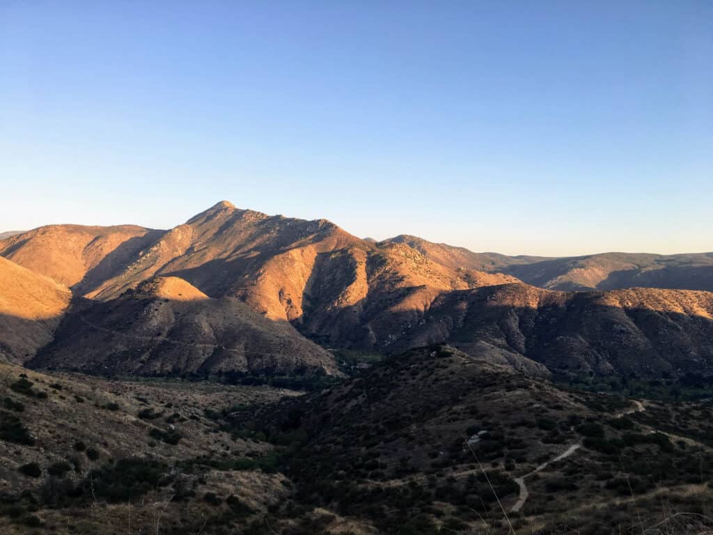
1. Volcan Mountain Summit/Five Oaks Trail
- Distance from Julian town center: 2.5 miles north
- Fee: Free
- Distance: 5+ miles
- Difficulty: Moderate
The area around the Volcan Mountain Trail has a strange feel, as it has avoided the wildfires that have devastated much of the nearby land. The devastation can be seen on plenty of hikes in the Laguna Mountains and Cuyamaca Rancho State Park (more on these areas later).
To see some of the best bird’s eye views of Julian to one side, and to catch a glimpse of the Pacific Ocean by turning to another direction, head up this trail.
On the Five Oaks portion of the trail, though much more narrow, you will find interpretive signs providing information about the surrounding vegetation and landscapes.
This trail is not for the faint of heart, as it gains around 1300 feet of elevation. Some portions are steep, but some sections are more forested, providing shade from the hot sun.
At the peak, the trail splits to circle around for 360 degree views. This is a great place to consider catching a sunset over the distant Pacific Ocean!
Julian Hikes in Santa Ysabel East Preserve
First of all: yes, there is an East and West Preserve! Plans to connect Santa Ysabel East and West are in the works, and the process of acquiring the private land between has begun. Even so, dividing the area into East and West is a great way to group the hikes.
Preserve hours are typically 8 am to sunset, and there is a gate at the entrance to the parking lot that a ranger comes by to unlock.
The East Preserve is home to over 13 miles of trails.
You may encounter cattle grazing during your hikes. Just give them their space and they won’t bother you.
It is estimated that the 2003 Cedar Fire burned over 65% of the Preserve, so you may still see burned tree remnants, as well as areas of replanting efforts.
2. Kanaka Loop Trail
- Distance from Julian town center: 3.5 miles north
- Fee: Free
- Distance: 7.5 mile loop
- Difficulty: Moderate
The Kanaka Loope Trail begins at Farmer Road Trailhead, which is located just about a mile north of Volcan Mountain Trailhead.
Both open, grassy areas and shaded stretches along a creek are found on this trail. Picnic tables are also situated in the shade along the creek, which could be a great place to stop for a snack!
3. West Vista Loop Trail
- Distance from Julian town center: 7.6 mi
- Fee: Free
- Distance: 3.3 mi loop
- Difficulty: Easy-Moderate
Access to this trail can be found from the Highway 79 trailhead.
The initial hike to the loop is quite steep, but once at the top, the trail flattens out significantly for a more leisurely stroll.
The loop is fairly shaded, and does provide a few grand views of the valley below.
4. Coast to Crest Trail
- Fee: Free
- Distance: 7.5 mi point to point
- Difficulty: Moderate
This trail, which connects the Kanka and West Vista Loops, is probably best hiked point to point if you can arrange pickup or drop-off. Hiking east to west, beginning at Kanka, is the easier of the two routes.
This hike contains plenty of elevation changes, variations between shaded paths and open fields, and lots of opportunities to view wildlife. You’ll likely come across cows grazing or napping at some point. Just give them their space!

Julian hikes in William Heise County Park
Heise Park is home to some great trails, which can be short or combined for much longer days depending on your hiking abilities and goals.
5. Canyon Oak and Desert View Loop
- Distance from Julian town center: 5 mi
- Fee: $3 day use fee
- Distance: 3 mi loop
- Difficulty: Easy-Moderate
These hikes in Wiilliam Heise County Park begin near the parking areas labeled for day use and trails. Despite the fee, they’re convenient!
The majority of this hike takes place in a woodland setting, but it does include some rocky, open portions, as well. Midway through the Desert View trail, just shy of 2 miles in, head towards Glen’s View viewpoint for you guessed it… a great view!
At Glen’s View, you’ll find a viewfinder. At the base, there are labeled lines. If you line up the scope with the line and look through, you’ll see the landmark it is labeled for!
Though this trail clocks in at just over 3 miles, but the loop intersects with the interpretive trail loop, which can be combined to add a little more distance if you’d like some extra exploring.
6. Kelly Ditch Trail
- Distance from Julian town center: 5 mi
- Fee: $3 day use fee
- Distance: 11.2 mi out and back (could also do as a point to point)
- Difficulty: Moderate
Trail Trivia: This trail is named for local rancher John Kelly, who dug this ditch to direct water runoff to Lake Cuyamaca.
The Kelly Ditch Trail connects William Heise County Park and Lake Cuyamaca. For a more pleasant experience, begin at William Heise County Park. This will get the tougher climbs over with earlier in the hike.
Park in front of kiosk and you will find signs for the trail. The trailhead and beginning of the trail is well marked.
Though some shade in the first few miles is a nice break from the Southern California heat, the trade off is a lack of any views during that stretch.
There is, however, plenty of wildfire evidence along this trail. Just appreciate the beauty of the new regrowth.
If you are hiking this trail as a long out and back, the Fern Trail branches off to offer an alternate route for about a mile or so. You could also make this a loop from Heise County Park if you do not wish to go the entire length of the trail.
Some consider the end of the trail at Highway 79, but if you continue across the highway less than half a mile, you will find yourself at Lake Cuyamaca.

7. Eagle Peak Preserve
- Distance from Julian town center: 5.6 mi
- Fee: Free
- Distance: ?
- Difficulty: Difficult (due to navigation)
Full disclosure: Despite the name, this is not the actual peak. The trails here are not well marked or maintained.
Why would you even consider hiking in this area, you ask? Well, the “Historic Trail” found here is the original route between San Diego and Julian. For the history buffs out there, this could be a cool experience.
The path follows the Rock Wall along the trail, which signals the original road, even though it is difficult to see along some stretches. This rock wall is the best way to stay on track.
For adventurous hikers, you can connect to Cleveland National Forest for a hike to a peak view. This may involve some bushwhacking, though.
8. Inaja Nature Trail
- Distance from Julian town center: 5.7 mi
- Fee: Free
- Distance: 0.5 mi
- Difficulty: Easy
Though these grounds are in the Cleveland National Forest, they are free to visit, as they are a memorial tribute.
During the 1956 Inaja Fire along the San Diego River, 11 firefighters lost their lives battling the blazes. A stone monument here memorializes those men, and picnic grounds offer a spot to stop for a bite to eat near a short trailhead.
Though this trail is one of the shortest on this list, it is worth a quick stop to stretch your legs and take in views of the San Diego River Gorge and valley. Of the Julian hikes, this one is definitely family friendly.
Find the path to the peak and you will come upon a viewfinder. Line up the viewfinder with arrows on the base, look through, and you will be able to put names with many of the landmarks in the valley.
9. Santa Ysabel West Preserve
- Distance from Julian town center: 8.1 mi northwest
- Fee: Free
- Distance: 5.5 mi long loop; Shortcut Trail cuts off 1+ mi
- Difficulty: Moderate
The West Preserve, like its eastern counterpart, also opens at 8 am.
The main hike here combines 4 trails to form the loop. Follow them in this order: Lower Creek Trail, Upper Creek Trail, Coast To Crest Trail, Ridge Trail.
If you aren’t up for this distance, hop on the Shortcut Trail connecting Upper Creek and the Ridge Trail, making the hike at least a mile shorter.
This trail can be steep, and the climbs and descents are rocky. Be sure to wear appropriate footwear!
Though mostly open, hot and dry in summer, streams can flow in the winter. Prepare accordingly for water crossings.

10. Lake Cuyamaca Recreation Park
- Distance from Julian town center: 9.0 mi
- Fee: $10 parking
- Distance: 3+ mi around the lake
- Difficulty: Easy
Another family-friendly hike that could be suitable for all ages, Lake Cuyamaca features a trail around the entire lake.
Minimal elevation changes classify this trail as easy.
Find a spot at the picnic areas for lunch or watch fisherman trying their luck. Just enjoy a few hours by the lake!
11. Three Sisters Falls
- Distance from Julian town center: 11.1 mi
- Fee: Free
- Distance: 4 mi
- Difficulty: Difficult
Though Three Sisters Falls used to be and still is a remote backcountry destination, it has become increasingly popular due to social media.
Photos of the 3 successive waterfalls, hence the name Three Sisters, are attractive for social media. Even more so? Photos of you swimming in the pools below.
DO NOT UNDERESTIMATE THIS HIKE BECAUSE OF DISTANCE.
It is infamous for it’s high number of rescues due to lack of preparation or overestimating abilities/experience.
The area gets really hot– over 100 degrees Fahrenheit in the summer. There is minimal shade. Plan accordingly and pack plenty of water. The Forest Service, though, has made changes and will close this trail if excessive heat is expected.
Recently, the US Forest Service cut a new section of trail to make the route easier and more eco friendly. The prior trail consisted of STEEP downhills, which required the use of ropes.
Recent photos from the falls looking back toward the hillside still show remnants of the old trail and the erosion that it has caused.
Another note about this trail is it is classified as an inverted trail. This means that the beginning is descent, so you will have the most strenuous part of the hike at the end. Don’t spend too much energy playing in the water pools at the falls, or you could find yourself needing emergency attention!
Plan ahead for this hike by bringing plenty of water, snacks, good hiking shoes, and common sense. Check the temperatures and look for a cooler day. Take your time, and enjoy the views! Three Sisters Falls is a sight to see, especially in the spring.
Side note: The road to the trailhead is a mountainous dirt road, but it is in good condition. It is narrow but accessible with a car.

Julian hikes in Cuyamaca Rancho State Park
12. Stonewall Peak
- Distance from Julian town center: 11.2 mi
- Fee: $10 day use payed at parking area
- Distance: 4 mi
- Difficulty: Moderate
The Stonewall Peak hike is one of the most popular hikes in Cuyamaca Rancho State Park and the region. Plenty of seasonal variety, including wildflowers in spring, changing colors in fall, and winter snow keeps hikers coming back for more.
This hike, like many other in this State Park, begins across street from Paso Picacho Campground. There is a $10 fee for using the campground’s day use parking area.
The summit of this hike features rock stairs to the peak, railing enclosures and interpretive signs at the boulder peak. Views of Cuyamaca Lake can also bee seen in the distance below.
You will see plenty of wildfire damage, which remains from the 2003 Cedar Fire.
13. Azalea Glen Loop Trail
- Distance from Julian town center: 11.2 mi
- Fee: $10 day use paid at parking area
- Distance: 4 mi loop
- Difficulty: Easy-Moderate
This is another of the Julian hikes that begins near the parking area of Paso Picacho Campground. Pay close attention to the trail markers here as there are numerous trails with plenty of junctions. Don’t just walk in circles!
You will catch glimpses of Paso Picacho Campground, still protected by trees despite the wildfires. Spectacular views of Stonewall Peak are a selling point of this trail as well.
See Azalea Spring with a small cistern, as well as morteros (mortar grinding holes in rock), signs of the historical inhabitants of the area.
14. Cuyamaca Peak
- Distance from Julian town center: 11.2 mi
- Fee: $10 day use paid at parking area
- Distance: 5+ mi out and back via paved fire road
- Difficulty: Moderately Difficult
The selling point of this hike is the second highest peak in San Diego county, behind only Hot Springs Mountain.
Yet another trail that begins Paso Picacho Campground, it’s vastly different from others in the area as you can hike to the peak via the Lookout Fire Road. If you’re looking for something that resembles an all purpose trail, this is it. The entire road is paved! The Julian hikes have something for everyone.
For those looking to get more adventurous, there is an alternate route. Begin at the Trout Pond Parking area, cross Highway 79, take Milk Ranch Road to Azalea Spring Fire Road. The Conejos Trail to the summit will clock in around 6 miles round trip.
15. Juaquapin Trail/Dyar Spring Loop
- Distance from Julian town center: 15.6 mi
- Fee: $10 parking fee if parking at campground
- Distance: 3+ mi
- Difficulty: Moderate
Access this trail via the Sweetwater Parking Lot off Highway 79. Heading south, it’s on the left.
Gorgeous views of the peaks in the distance are featured on much of this trail.
Though you may be checking out all the endless views, keep your eyes peeled. You may come across plenty of wildlife! Be aware of your surroundings, as you may come across a rattlesnake or big cat.
This trail can be as short as a 3 mile loop via East Side Trail, or can be combined with other trails for much longer all day hikes.
16. Green Valley Falls Trail
- Distance from Julian town center: 17.0
- Fee: $10 day use fee at camp parking lot
- Distance: 1.5 mi roundtrip
- Difficulty: Easy
If you’re looking for a well marked, family friendly hike, look no further!
This trail is easy and the payoff at the end is a small seasonal waterfall, which can be refreshing to dip your feet in!
Find the trailhead at the picnic area near the Green Valley Campground parking lot.
17. Cedar Creek Falls
- Distance from Julian town center:
- Eagle Peak Rd Trailhead 12.0 mi
- Ramona Trailhead 25.6 mi
- Fee: $10 permit from US Forest Service covers up to 5 hikers
- Distance:
- Eagle Peak Road: 5+ mi (could be longer if taking the side trail to Cedar Creek and the top of the falls
- Ramona: 6 mi
- Difficulty: Difficult
There are 2 access points for Cedar Creek Falls. The more popular is at the end of a residential Ramona street. The other can be found from Julian off Eagle Peak Road.
The Ramona Trail is extremely well marked and maintained. Plenty of mile markers are dispersed along the trail, informing hikers of distance. There is minimal shade on this hike as most is on the hillsides.
The Julian Trail, beginning at the Saddleback Trailhead, is the shorter of the two but could be extended by taking the side trail to the creek and top of the falls. After heavy rains, catch a glimpse of Mildred Falls on the hillside, as well, about 1.5 miles in.
These trails are also classified as difficult due to typical scorching 100+ degree heat, as well as also being inverted hikes. Bring lots of water! We found it enjoyable to start the hike later in the day and do the downhill portion while the sun was at a higher point. On the way out, we found some shade from the hillsides.
The payoff for these Julian hikes is the 80 ft Cedar Creek Falls, but it is a seasonal waterfall. It does not flow in the mid-summer/ fall. The pool below is stagnant and filled with algae. Not really ideal for swimming!
Cedar Creek Falls gets really busy, especially on the weekends and holidays, and a permit is required to access the falls. Secure your permit ahead of time. Cell reception on parts of trail/at falls is shoddy at best, and passes are limited. They may sell out during peak visiting season.
This trail has a reputation for high number of rescues required per year. With that being said, there are some rules for this particular trail that must be followed. Plenty of injuries and multiple deaths have occurred on this trail, so please don’t underestimate it.
Typically, rescues have been related to heat related illness and dehydration, especially prior to the alcohol ban. Though dogs are permitted on this trail, we don’t recommend bringing them along. Countless dog injuries and deaths have occurred due to heat.
- Absolutely no alcohol on the trail
- No climbing or jumping from rocks around the falls or pool (not deep)

18. Eagle Rock via Pacific Crest Trail (PCT)
- Distance from Julian town center: 20.5 mi
- Fee: Free
- Distance: 6.5 mi out and back route
- Difficulty: Moderate
The Pacific Crest Trail covers 2,650 miles from the California-Mexico border to the Washington-Canada border. It’s a bucket list trail for many avid hikers and backpackers.
This stretch of the PCT follows Cañada Verde Creek for a bit, and strange boulders that don’t look like much will warn of the end. Hike to the outer side of these boulders and you will find a formation that looks like eagle with wings spread wide!
Park across the street at the Community Resource Center or areas that say public parking. DO NOT BLOCK FIRE STATION!
Bonus: More Julian hikes to Look at With Camping & Trails
Anza-Borrego Desert State Park
- Distance from Julian town center: 13.0 mi
- Fee: $10 day use
- Distance: Varies
- Difficulty: Easy-Difficult
A wide variety of hikes can be found within this 585,930 acre state park, ranging from easy 1-mile strolls, to strenuous multiday backpacking adventures. The Pacific Crest Trail makes its way through the park.
Different wildlife and vegetation plant their roots here, including palm groves, flowering cacti, and bighorn sheep!
A few easier self-guided hikes can be accomplished using accompanying brochures on the state park website.
You can also camp here for multiple days of hiking.

Laguna Mountain Recreational Area
- Distance from Julian town center: 20 mi
- Fee: Day use $5/24 hours, Annual Pass $30 for Adventure Pass
- Distance: Varies
- Difficulty: Easy-Difficult
These Julian hikes can also be found in the Cleveland National Forest, which requires an adventure pass for use.
Mount Laguna is home to many shorter day hikes, as well as two trail options for backpacking. Overall, the area contains 70 miles of trails, including a portion of the PCT.
Another notable feature: you may be able to find waterfalls along Laguna Creek. Who doesn’t like a good waterfall?
Camping is also available in this area.
Palomar Mountain State Park
- Distance from Julian town center: 32 mi
- Fee: $10 day use
- Distance: Varies
- Difficulty: Easy-Difficult
This state park is home to 76 hikes, covering all difficulty levels.
Some of the more popular trails are the Observatory Trail and Doane Valley Nature Trail.
Camping is available in this area.

Summarizing the Julian Hikes
Though San Diego is quite popular for outdoor adventurers, we urge you to branch out and visit the town of Julian. You will find plenty of hiking trails for every ability level. After you finish your hikes, enjoy some candy from the old fashioned candy shop or a slice of Julian’s famous apple pie!
Get out and enjoy these Julian hikes!