Exploring Alpha Falls at McConnells Mill State Park

Though Alpha Falls is not the most powerful of McConnells Mill State Park’s waterfalls, this one is the tallest single drop of any of the waterfalls in this park. Alpha Falls drops about 60 feet!
You might miss the stream it is fed by, especially in the hot summer months. It’s tiny!
We’d recommend you catch this waterfall after a period of heavy rain or after the snowmelt. The best visits we’ve had were in late March or April when there has been a decent amount of snow.

Where to begin your hike to Alpha Falls
Depending on how much time you have available, Alpha Falls could be a quick stop or a destination.
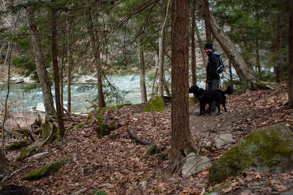
The quickest way to get there is to park in the small, unpaved Alpha Pass parking area off of McConnells Mill Road.
There is room for 4-6 cars in this parking area. If this spot is full, continue on McConnells Mill Road to the split and park in the larger Point Parking Area. It’s not far down the road.
As soon as you get out of your vehicle, you’ll be able to hear the sounds of the waterfall over the hillside. If you can hear the sounds of rushing water, that’s a good sign of a beautiful waterfall view when you get down to the base.
Catch glimpses of the falls through the leaves next to the one-table picnic area. It’s not a spectacular view, but more of a peek into what is to come.

How to get to Alpha Falls
On the left side of the parking lot, you’ll see a sign for the North Country Scenic Trail. Yes, you’ll get to take a few steps on the NCST to get to Alpha Falls!
The trail begins as a dirt and wooden staircase heading down towards Slippery Rock Creek.

Follow the steps down the hillside just a short distance, 20-25 yards down the trail, and you’ll notice a single-track trail to the right. Take that path! It is unmarked, but it’s a well-worn path.
Continue a little further, and you’ll come to a small wooden footbridge. Cross this footbridge, and you’ll start to see the falls through the foliage.

In the colder months, you’ll walk right next to some rock overhangs and cliffs featuring some gigantic icicles! Hiking to these falls will take you no more than 5-10 minutes from here.
Spend some time exploring and photographing at the base of the falls.

From here, continue down the creek bed to a small beach on Slippery Rock Creek, or retrace your steps back to the North Country Trail to continue hiking other trails in McConnells Mill.
If you want to go on a long day hike through the park, it’s possible to hike the whole way to Hells Hollow Falls along Slippery Rock Creek, with sections following the NCT.
It’s a really long hike, but it’s a beautiful route along the water. Just be ready for 15+ miles, out and back.

Alternative Routes
A little longer, but even more beautiful is hiking along Slippery Rock Creek from the mill and covered bridge.
Hiking from here to the falls will cover a little over a mile round trip, but most of the way includes the creek and weaving around the large boulder formations that the park is known for.
To explore the entire length of the park, hike from Alpha Pass to Hells Hollow Falls and back, which will cover about 15 miles, as we mentioned.
This hike wouldn’t be for the faint of heart, but you’ll really get to experience everything that the area has to offer. You might even get to see some whitewater kayakers heading down Slippery Rock Creek as you hike.
We enjoyed a short stop to watch a small group of them navigate a few of the rapids.
Other Must-See Spots in McConnells Mill?
If you’re looking for more waterfall adventures, hike a little further to Hells Hollow Falls and Breakneck Falls.
Make sure to see the mill and covered bridge, too. You wouldn’t want to miss the park’s namesake. The vast majority of photos you see from this park are from the mill and covered bridge area.
When in season, plan a picnic near one of Slippery Rock Creek’s rapids and watch the whitewater kayakers pass on their adventures.
McConnells Mill is one of our favorite day-use state parks because the hikes are beautiful. There is also a little variety of things to do and see in McConnells Mill State Park.
Places to Explore near McConnells Mill
Are you looking for more waterfall adventures? You’re in luck! Within two hours of driving, you can reach Cuyahoga Valley National Park in Ohio or Ohiopyle State Park on the southern border of Pennsylvania. Both of these parks feature multiple beautiful waterfalls.
If you’re looking for something nearby, check out Moraine State Park to kayak Lake Arthur, bike, hike, or swim. It’s only 5 minutes down the road and features great hiking, biking, fishing, and boating opportunities.
Have you visited Alpha Falls or any of the other McConnells Mill State Park waterfalls? Which one is your favorite?